
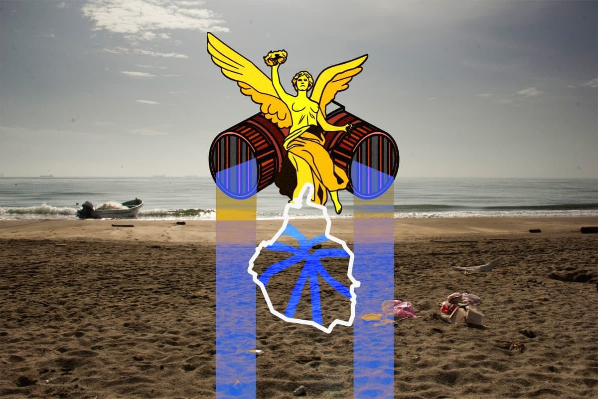
From synthetic microfibers such as polyester, plastic waste, batteries, oils to dog feces and even human remains are part of the waste that Ahjaima has found in rivers in the State of Mexico and in the drainage network that connects the Mexican entity to Mexico City.
Ahjaima is a biologist, graduated from the Autonomous Metropolitan University (UAM). He has been researching pollution in the Mexican municipality of Ecatepec and in the east of the Mexican capital for more than 15 years.
The waste mixture forms leachates, he explains, a toxic liquid that is generated when water passes through waste and carries away chemicals, organic matter, metals and bacteria. “They are highly toxic, leaking into the subsoil and underground rivers,” he says.
The deep drain in Mexico City carries part of the wastewater from the Metropolitan Area of the Valley of Mexico to Hidalgo, where it is incorporated into the Tula River and continues through the Moctezuma and Pánuco rivers until it flows into the Gulf of Mexico. However, this basin was left out of the 30x30 goal, which seeks to protect at least 30% of land and marine surfaces by 2030.
In 2024, treatment plants processed an average of 31,716 liters of wastewater per second, of which 19,029 came from Mexico City. This flow is equivalent to 1.64 million cubic meters per day, enough to fill an Olympic pool such as Francisco Márquez about 658 times. These waters continue to flow down the El Salto River, on the border between the State of Mexico and Hidalgo, where runoff from the Valley of Mexico gives rise to the Tula River.
Treatment plants remove much of the organic matter, although they don't completely remove heavy metals, microplastics and other chemicals. A study published in 2019, entitled Measurement of Illicit Drugs in Wastewater: Pilot Study in Mexico, identified metabolites of cocaine, marijuana and other drugs, including benzoylecgonine, THC-COOH and methamphetamine.
In 2023, an investigation led by Juan C. Duran-Álvarez analyzed wastewater from Mexico City and the Mezquital Valley, Hidalgo, for 30 months. The study identified drug residues such as famotidine, indomethacin, dexamethasone, azithromycin, and ivermectin.
In the Mezquital Valley, other research, published in 2018, analyzed 218 organic pollutants in wastewater, springs and groundwater. The results recorded 65 of the 118 pharmaceutical compounds evaluated, three of the seven reproductive hormones tested, and benzoylecgonine, a metabolite of cocaine.
Meanwhile, Ahjaima collects at least five types of plastic during eight-hour days and inspects canyons up to 20 meters high covered with waste. In this work, he has learned to distinguish seven types of household plastics and to recognize synthetic microfibers that reach the drain.
“Almost everything is polyester, one wash and you go I don't know how many grams of microplastic,” he explains about the fibers that synthetic garments shed during washing.
Although the chemical analysis of these flows requires specialized resources, Ahjaima describes what he observes in the water: “It is evident that this is completely rotten and intoxicated in all colors and flavors.”

When the Valley of Mexico had no access to the sea
In pre-Hispanic times, the lakes of Texcoco, Mexico, Xochimilco, Chalco, Xaltocan and Zumpango were connected by channels that allowed canoes to travel between chinampas and cities. After the floods that affected Mexico-Tenochtitlan, Moctezuma I commissioned Nezahualcóyotl to build a dam in Texcoco in 1449.
After the conquest, floods prompted the construction of an artificial outlet for the basin. In 1607, Enrico Martínez began the drainage to Huehuetoca through the Nochistongo hole. At the end of the 19th century, the 47.5 kilometer Grand Drainage Canal was built, which carried water from San Lázaro to Zumpango and the Tequixquiac tunnel, with an exit to the Tula River. Porfirio Díaz inaugurated the work on March 17, 1900.
During the 20th century, the Second Tequixquiac Tunnel, the Deep Drainage System and the Central Emitter Tunnel, as well as the Eastern Emitter Tunnel, expanded the capacity to dislodge waters from the Valley of Mexico to the Tula River basin.
For communities near the river, wastewater was incorporated into the landscape and into daily life. René Romero Rivera, who grew up near the Tula River and the Viejo Requena Canal, in Hidalgo, remembers that his play spaces were plots irrigated with sewage.
“The water was there, but you couldn't interact with it,” she recalls. At home, they warned him that he could harm him and asked him not to come near him. If someone fell into a sewage ditch, he explains, they could suffer from skin problems.
“Part of the normal landscape, in quotation marks, that touched me, because it was the sewage river and a sewage channel, which is the Old Requena channel,” he says.
500 kilometers of route to the Pánuco River
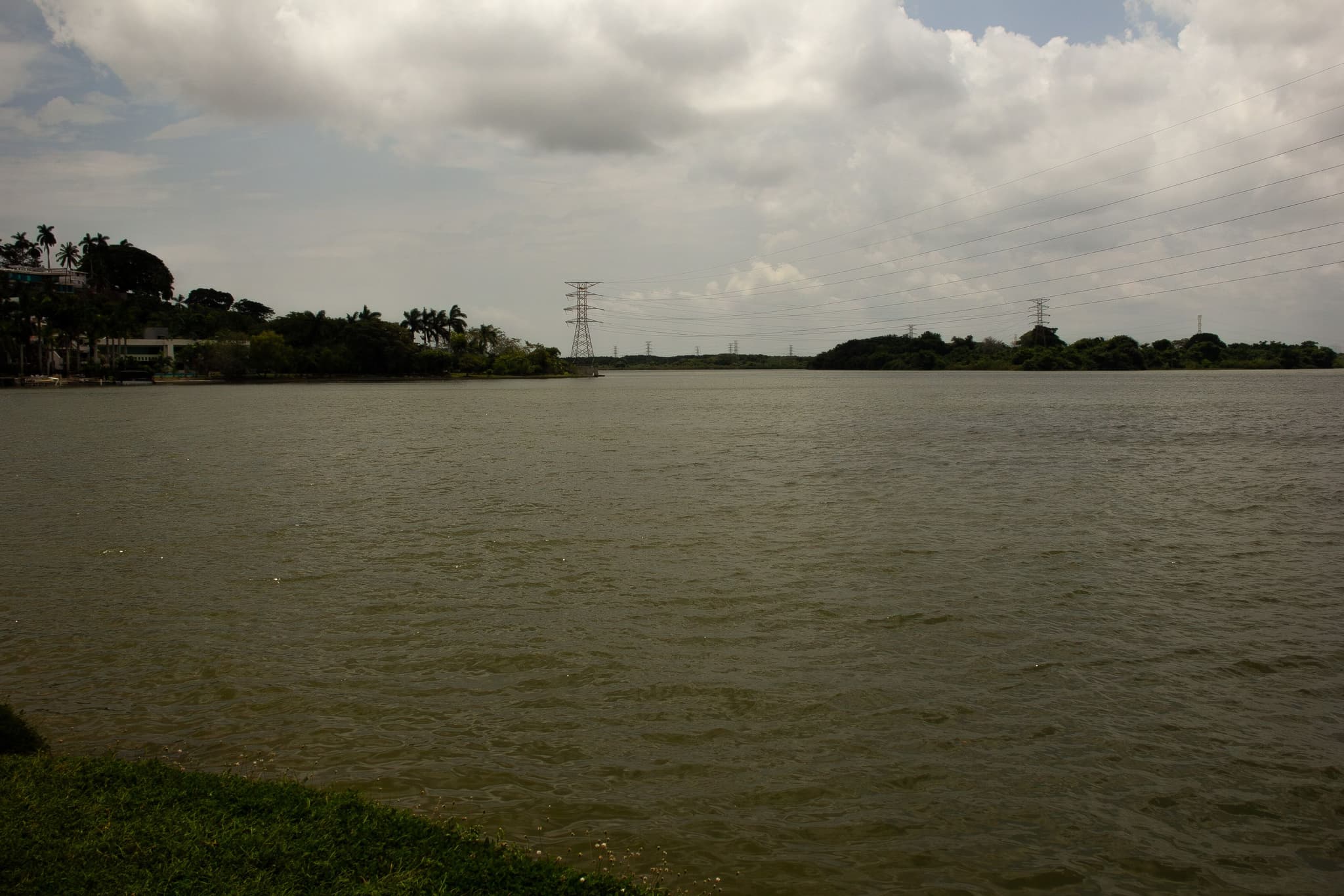
“We are standing at the mouth of the majestic Pánuco River, one of the largest in Mexico. You can see how it reaches the sea and impacts the Gulf. This river originates in the highlands of Mexico City,” explains José Jaime Salinas Carús, a biologist dedicated to environmental education and wildlife conservation in Tamaulipas.
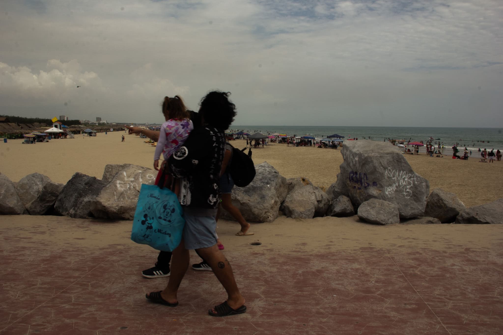
From the Tampico boardwalk, where a beach of more than 100 meters borders the Pánuco River, Salinas Carús explains the water route. “That water falls to Tula, Hidalgo, where it is used for agriculture and vegetables. It then descends through the Moctezuma, Tancochín and other rivers until it merges into the Pánuco River. From La Bocana to Mexico City there are 500 kilometers long.”
To interpret the relationship between pollution in the basin and the sea, Melanie Kolb, a researcher at the Institute of Geography of the UNAM, who specializes in environmental governance and water management, explains that “the Pánuco River represents an extreme case of concentrations and mixtures of pollutants”.
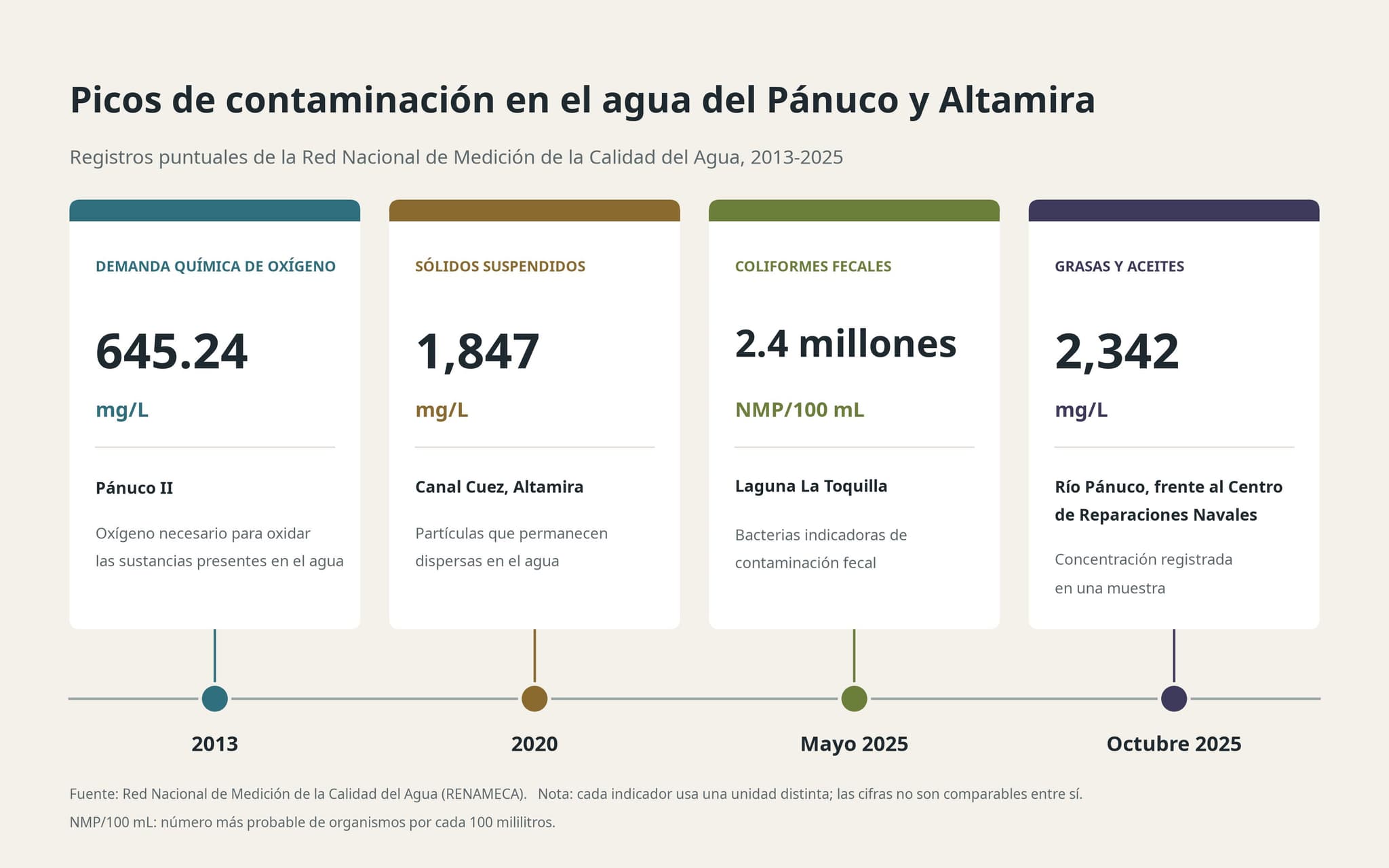
In March 2021, a sample taken at the breakwaters of Miramar Beach, in Ciudad Madero, registered 295 NMP (Most Probable Number) of fecal coliforms. The state health risk map attributed the result to the dragging of contaminated water from the Pánuco River into the sea during the rainy season.
Contamination is also documented in the agricultural areas of the Mezquital Valley. A study published in 2017 in the journal Water Research compared communities exposed to wastewater irrigation with others that used well water. Among children under five, the prevalence of diarrhea during the week prior to the survey was 10% in exposed communities and 5% in unexposed communities. The research, entitled Health risks from exposure to untreated wastewater used for irrigation in the Mezquital Valley, Mexico: A 25-year update, examined the health risks associated with this exposure.
The Mouth of the Panic
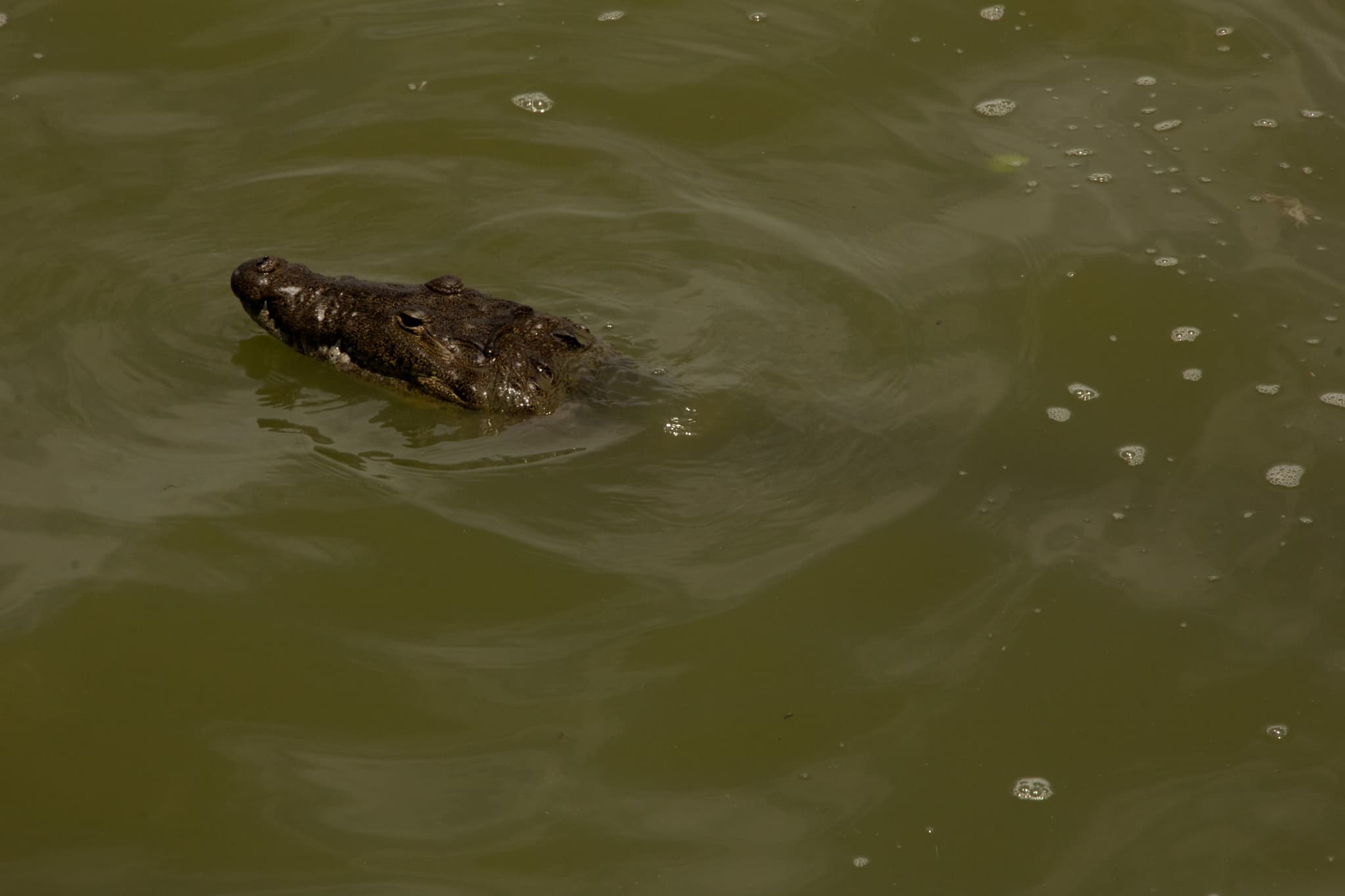
About eight kilometers from the mouth is Laguna del Carpintero, in the urban area of Tampico. There, a crocodile catches a dead fish next to a discharge.
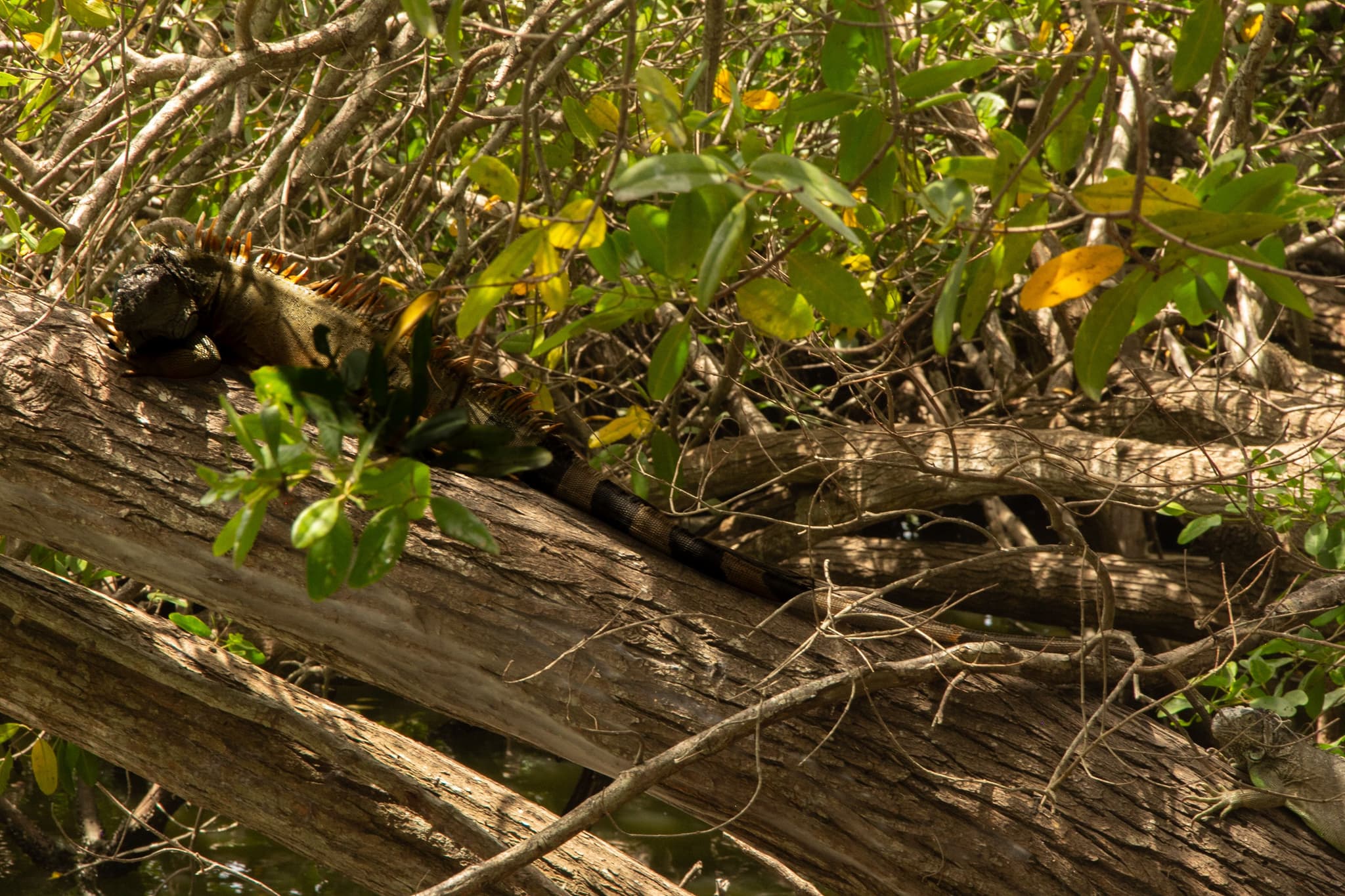
The lagoon covers 157 hectares, of which 77 correspond to the body of water. The rest includes land with sports facilities, recreational spaces and cultural venues. On its shores, iguanas move among the vegetation. The mangrove covers part of that perimeter and has lost surface area over the past two decades.
“As we are losing the mangrove forest, we are losing that natural barrier and we are allowing all these pollutants to reach the sea directly,” explains Gustavo González Hempel, a lawyer who has been involved in his defense since 2007.
Below us, he points out two discharge points: “In this part we have a discharge of sewage. Beyond that, another discharge where you can see fats and oils.”
“The lagoon connects with the Pánuco River through the Canal de la Cortadura, about eight kilometers from the Gulf of Mexico. The main tributary of Laguna del Carpintero is the Pánuco River, since it communicates through the Cortadura channel, and with the exchange of tides and the current of the river, brackish water and fresh water enter the lagoon basin,” explains González Hempel.
Mangroves play a role in this exchange of water and in the habitat of different species. “It is a filter for brackish water and its roots are, colloquially we can say, a kind of nursery for the fauna and various organisms that are reproducing there,” he says.
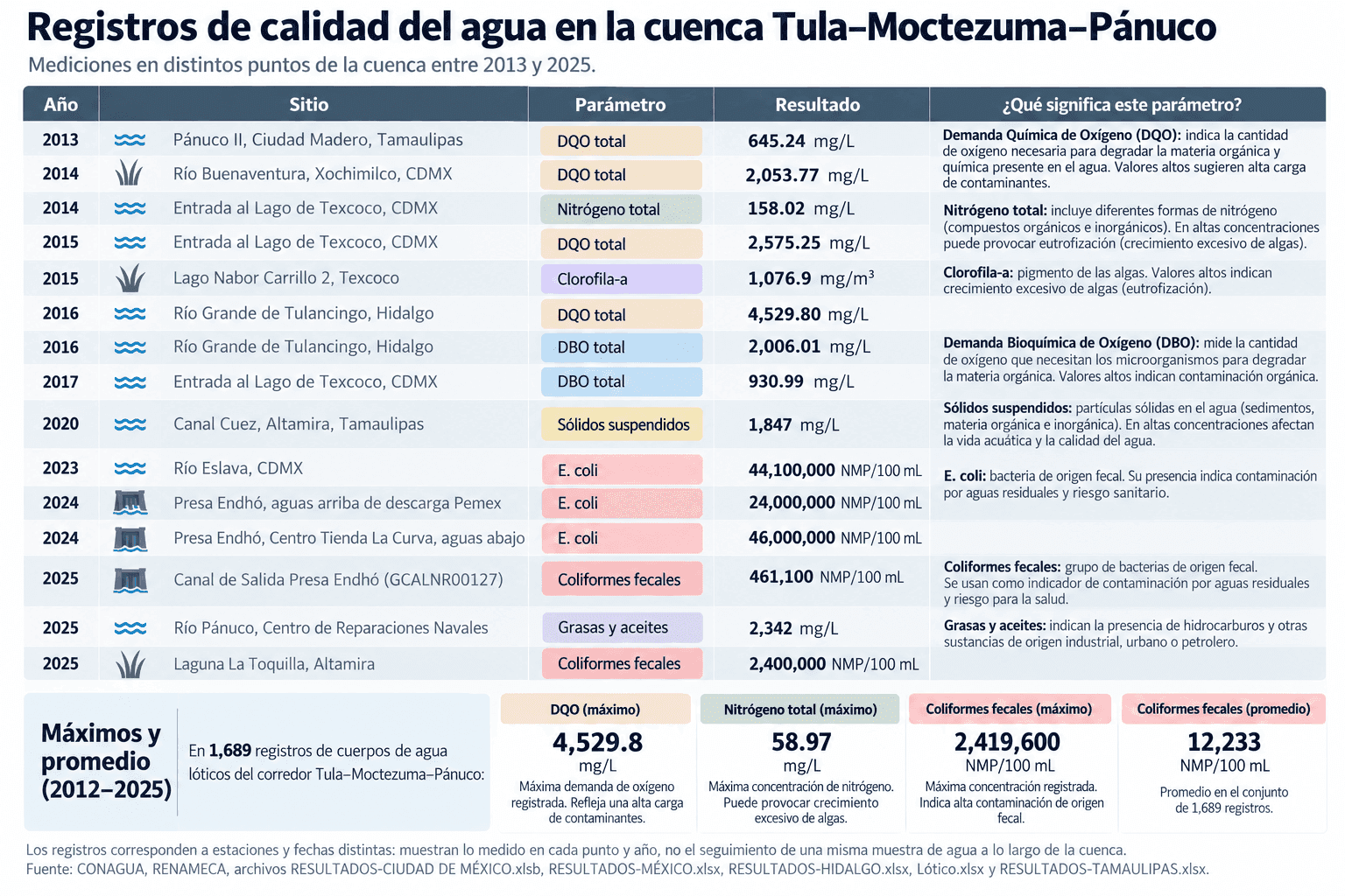
They forget about Panic in the global goal
In December 2022, Mexico adopted Goal 3 of the Kunming-Montreal Global Biodiversity Framework, which sets out to conserve at least 30% of land, marine-coastal and inland water surfaces by 2030.
In October 2025, SEMARNAT reported that 14.65% of the country's land surface and 23.78% of the country's marine surface had some category of protection. To reach 30%, he estimated that 30.8 million terrestrial hectares and 19.6 million marine and coastal hectares should be incorporated.
In the CONABIO Priority Sites for Biodiversity Conservation proposal, terrestrial, marine and epicontinental water areas relevant to conservation were identified, including the Pánuco River, explains Melanie Kolb.
The river is recognized as a priority site for biodiversity, although it was left out of the areas of intervention of Mex30x30. In June 2024, SEMARNAT and the Mexican Institute of Water Technology (IMTA) prepared the Technical Justification Study to Declare the Area of Influence of the Endhó Dam in Hidalgo as an Ecological Restoration Zone.
The document contains diagnoses on water quality and the presence of heavy metals in soils and crops. The proposed zone includes the area of influence of the Endhó dam, but leaves out the Moctezuma and Pánuco rivers, which receive water from the Valley of Mexico.
When requesting information from the IMTA about both basins through transparency, its Water Quality and Ecology Coordination replied that it had not carried out studies on these bodies of water or on the effects of waste discharges on them.
Faced with this scenario, Melanie Kolb points out that “the available information, even if it is imperfect or deficient, is more than enough to act immediately”.
Download permissions in El Pánuco
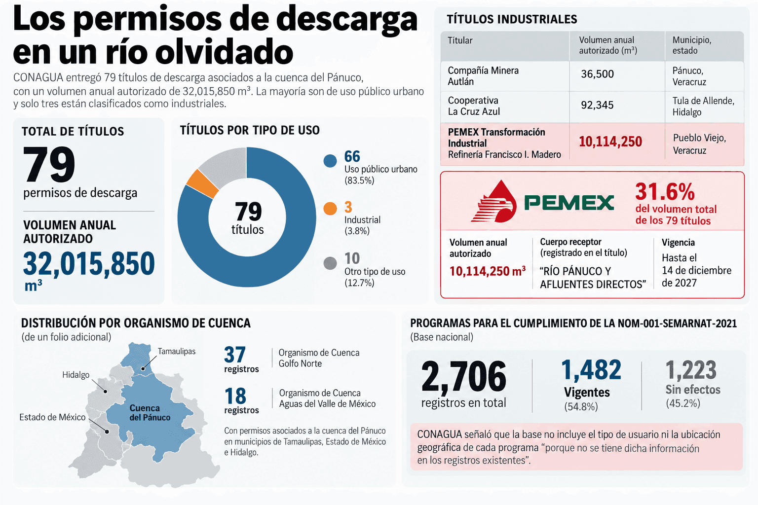
The industries have discharge concessions linked to the Pánuco River corridor. The CONAGUA records identify 79 titles with an authorized annual volume of 32 million cubic meters, equivalent to more than 12,000 Olympic pools.
The permits correspond to 65 holders distributed in Hidalgo, San Luis Potosí, Veracruz, Tamaulipas and the State of Mexico. Most are for urban public use, but there are also authorizations for industrial and service activities.
In Pueblo Viejo, Veracruz, PEMEX's Francisco I. Madero Refinery has granted authorization to discharge more than 10 million cubic meters annually to the river. This volume represents almost a third of the total authorized in the records analyzed. The permit is effective until December 14, 2027.
Regarding the rest of the records, which include permissions in Tamaulipas, State of Mexico and Hidalgo, their exact location and type of user are unknown, since CONAGUA replied that “there is no such information in existing records”.
The species that disappear from the Panucus
In Tampico, residents relate the changes in the Pánuco River to the decline of species in the region. José Jaime Salinas Carús, who participates in activities to protect the parrot turtle and in research on crocodiles in the Garrapatas estuary, in Altamira, recalls that Tampico means “place of water dogs”, in reference to otters, which, he says, “are rarely seen anymore”.
“Many native species have disappeared or have been displaced. The animals have been protected by going to cleaner basins such as the Tamesí-Champayán basin,” he explains.
In the lower Pánuco basin, wetlands, mangroves, marshes and lagoons converge, with freshwater and marine environments. At least 85 species have been documented in these ecosystems, including oysters, snails, shrimp and prawns. The region concentrates agricultural, industrial, fishing, port and navigation activities.
The transformation also reached the coast. Salinas Carús describes changes in sand accumulation and loss associated with breakwaters built during the Porfiriato. On the north side, the structure has helped the beach to gain ground from the sea, by modifying the transport of sediments.
Luis Humberto Salinas Ramírez, musician and businessman, has known the coasts and lagoons of Tampico since he was a child. For 14 years he had a floating business in Laguna del Carpintero and located the sources of pollution that reach the area.
“It's contaminated with phosphate, potassium, fertilizers, all the vinasse that comes from sugar mills [...] but there are a lot of heavy metals that are going to go into the sea,” he says.
While speaking, a boy travels across the lagoon in a boat with his father and grandfather.
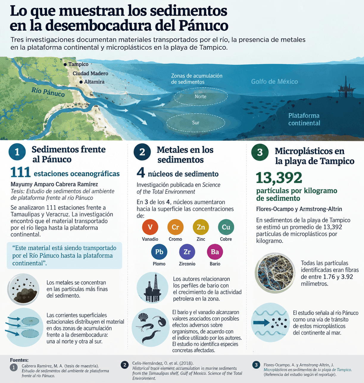
Research on sediments makes it possible to document the presence of pollutants at the mouth and coast of Tamaulipas. Mayumy Amparo Cabrera Ramírez's thesis analyzed 111 oceanographic stations off Tamaulipas and Veracruz, and documented the transport of materials from the Pánuco River to the continental shelf.
A study published in 2018 examined four seabed sediment cores off Tamaulipas. In three, he found increasing concentrations of vanadium, chromium, zinc, copper, lead, zirconium and barium towards the surface layers. Barium profiles registered increases of between 30 and 137% after the opening of oil facilities.
The researchers linked these changes to the growth of oil activity in the Gulf of Mexico. In the deep waters of the Gulf, a study published in PNAS in 2026 analyzed more than a decade of wildlife records and documented a decline in their populations after the Deepwater Horizon spill, which occurred in 2010.
Between 2011 and the sampling period from 2015 to 2023, the abundance of fish decreased by 63.5%; that of macrocrustaceans, 62%, and that of small cephalopods, 59.7%. For the analysis, the researchers examined more than 2,000 samples and performed acoustic measurements.
In addition, off the coast of Tampico, other research published in 2023 by Itzamna Z. Flores-Ocampo and John S. Armstrong-Altrin, from the Institute of Marine Sciences and Limnology of the UNAM, analyzed microplastics in beach sediments. The researchers found an estimated average of 13,392 particles per kilogram of sediment. They were all fibers and polyester was the most abundant polymer.
The study points to the Pánuco River as a route for transporting microplastics from the continent to the sea.
The solution starts in the City
Melanie Kolb uses the ridge to reef approach to study the connection between what happens inland and its effects on coastal and marine ecosystems. The conclusion is that pollution reaches the sea through rivers and through the removal of sediments.
Both deforestation and construction remove vegetation cover and promote the transport of particles to riverbeds. Untreated wastewater incorporates drugs, chemicals and pathogens.
“A problem generated in one system, such as urban areas, industrial developments or agricultural activities, is transferred to another system, in this case to the Pánuco River and then to the coastal and marine area,” explains Kolb. This transfer of impacts between systems is called transistemic impacts.
To restore rivers, the researcher points out that “the fundamental principle in river restoration is to stop polluting them at the source”. By interrupting polluting discharges, he explains, “the ecosystem begins its progressive recovery”.
Kolb proposes to complement chemical laboratory analysis with participatory monitoring and citizen science. Through simple protocols, communities can assess the conditions of their rivers using bioindicators, such as aquatic insects.
“Simple sampling with spoon nets, the presence or absence of insect families allows us to classify water quality into three basic categories (good, regular, poor),” he explains. “The conventional chemical laboratory analyses carried out by CONAGUA are costly and impossible to deploy along the entire course of a river.”
The Mexican government made international commitments to reduce pollution that threatens biodiversity and conserve continental waters by 2030. Kolb points out that “Mexico has the necessary technical data to execute this goal, but the lack of personnel, operational capacity and political priority within organizations such as CONANP has prevented this information from being translated into reserves and effective management measures.”
Goal 7 of the Kunming-Montreal Global Biodiversity Framework sets out to reduce pollution risks to levels that do not harm biodiversity. Goal 3 includes the conservation of inland waters. For the Pánuco River, meeting these commitments requires that conservation also consider the quality of the water that leaves the Valley of Mexico in the basin and that reaches the Gulf of Mexico.
This report was produced with the support of Internews' Earth Journalism Network.


Comentarios (0)