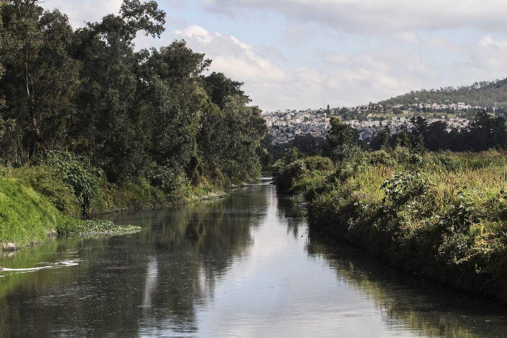
The floods on the Cuemanco bridge, in mid-October, revealed the consequences of building in the wetland, said neighbors who make up the Coordination of Towns, Neighborhoods and Colonies of Xochimilco in Mexico City.
This is due to the floods due to the rains reported between October 8 and 11 in lanes of the “Cielito Lindo” bridge, at the Cuemanco highway distributor, inaugurated in September of last year.
Although the government of Mexico City managed to control the waterlogging by placing sacks and draining the water, for residents of the Xochimilco Coordination, these floods are a consequence of the construction of the bridge and damaging the wetland.
“Since its construction, there have been more floods in the area, even nearby neighbors were flooded on the same dates, but to a certain extent it was evident because part of the wetland that did allow water to filter was removed and replaced with gravel and cement,” said Armando Velázquez, member of the Xochimilco Coordination.
Despite this, the new General Land Management Program (PGOT) proposed by the capital's government, which is a guide to what and how to build in the city until 2035, proposes the category of rural land in areas that are currently categorized as conservation. Mainly, those that have been impacted by irregular settlements.
Previously, land was only divided into conservation and urban, but by mandate of the Political Constitution of Mexico City, this time the zoning classification will also include that of rural land.
“The problem is that with rural land, economic and productive development activities can be carried out in more places, even where there are currently no human settlements. So the concern is that they will reach these conservation areas, which are important because water infiltrates,” Velázquez explained.
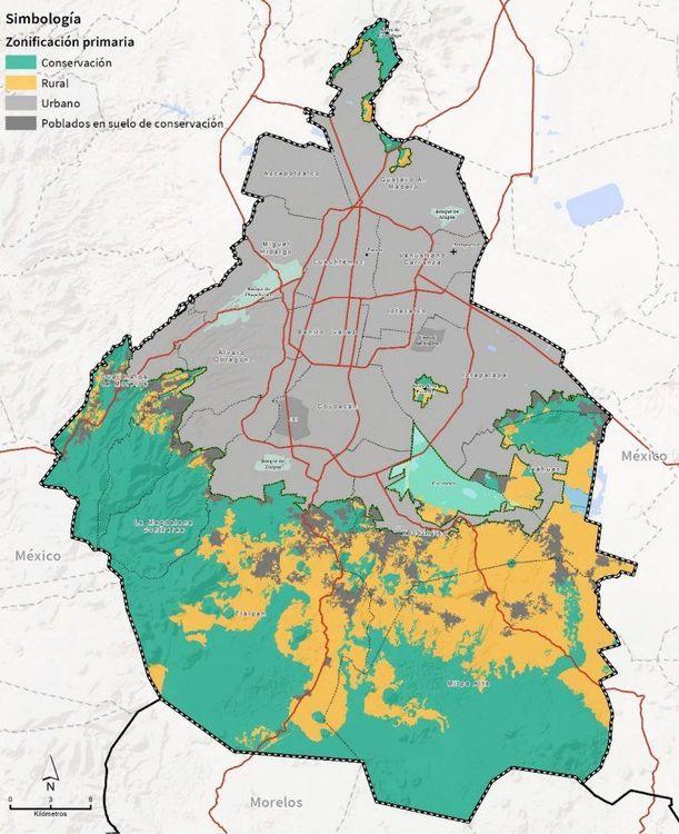
In yellow, the new areas classified as rural land, previously classified as conservation areas. Source: PGOT.
According to the PGOT, rural land allows only agricultural, livestock, fish farming and agro-industrial activity, in addition to the arrival of rural villages with a low population density, as well as equipment with commerce and support services.
In addition to the changes in the zoning of the city, residents also fear that there will be irregularities that will allow real estate developments to enter the south of the city with the objective of building residential or entertainment areas.
Mainly in the Water Forest, as the wooded region that goes from the Tepozteco, the Sierra del Chichinautzin and the Zempoala Lagoons; to Ajusco and the Lion Desert is known.
In 2014, Alejandro Velázquez recalls, the mobilization of organized neighbors already led to the suspension of the Tepepan Country Club Fracción, a residential development project and equestrian club, in Santa Cruz Xochitepec, Xochimilco.
For its part, in the Cuemanco area, the Xochimilco Coordinator has proposed the demolition of the bridge, from an environmental perspective, and to improve public transport in the area.
“What should really concern us all here is the water issue. Mainly what would happen if wooded areas open up to rural land and have repercussions on the aquifer of the Metropolitan Area,” added Velázquez.
Meanwhile, a mobilization will be called for on November 10 to oppose land planning proposals that have to do with everything that favors the real estate sector.
In turn, the Coordination is preparing a document that they will submit to the Institute for Democratic and Prospective Planning of the capital with points that they consider should be reconsidered in the proposal of the General Territorial Planning Program, which is still under review.

Comentarios (0)