One day after civil organizations warned about a new oil spill in the Gulf of Mexico, Petrleos Mexicanos (Pemex) has confirmed the spill but refuted the data on the size, volume and duration of this accident.
This is the same Cantarell mining area in the Gulf of Mexico, where there was a recent fire on Pemex's Nohoch-A platform on July 5.
On July 18, Pemex stated in a statement that it is 58 cubic meters, in an affected area estimated at 0.06 square kilometers and denies that it is 400 kilometers or a thousand cubic meters, as a group of civil organizations reported on July 17.
The State company also denied what was stated by geographer Guillermo Tamburini, who participated in the organizations' complaint that the spill was still in force.
“The leak has been completely repaired,” the oil company said in a statement.
“The two leak points in the duct were small fissures 7 centimeters long by 1 millimeter wide and a pore 1.2 centimeters in diameter. Given the small size of the cracks, the volume of hydrocarbons that escaped was minimal,” reads the letter.
Complaint from organizations
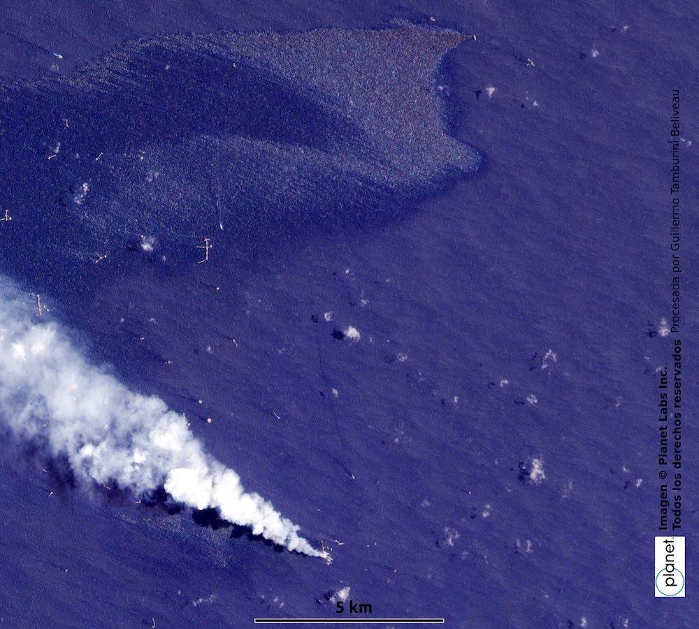
Tamburini showed at a press conference that there are satellite images showing the spill that would have started between July 3 and 4.
Pemex did not deny that this could have been the start date, instead only specifying that it reported the leak to the Security, Energy and Environment Agency, an agency responsible for ensuring the environment in the face of the hydrocarbons sector, on July 6.
Tamburini noted that the observation of the area was done with satellite images. They, he said, indicate that at a distance of about 15 kilometers from the Nohoch platform, there is a “large stain on the surface of the water, which can only fit because it is a hydrocarbon spill and indeed after a more detailed analysis it is corroborated”.

Satellite image shows spill stain on the top. Picture: Tamburini.
Using a radar image, a type of electromagnetic wave treatment that does not handle light and that allows spills to be dimensioned, the geographer accused that the spill was still in force.
“Evaluating the volume of this spill is complex, of this and any spill. Because you have to know very well the thickness of any spill on the sea, it can vary by many orders of magnitude,” Tamburini explained.
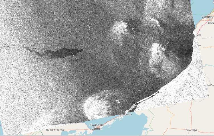
Radar image, positioned according to the map. Image: Tamburini
He also spoke of a second vanishing point of up to 500 cubic meters, but Pemex did not emphasize its response to it, other than mentioning “two vanishing points” that comprise the same spill.
Debate
Although the geographer stressed that their estimates are calculations, since they do not have the resources to reach the area and asked the authorities to provide information, Pemex has come out to point out the calculation of the extension granted initially as in “bad faith”.
The accusation of the oil company adds to a series of disagreements between the current federal government and the scrutiny by other sectors surrounding Pemex and in recent days since the Nohoch-A platform fire on July 5.
In their initial complaint, civil organizations pointed out that they encountered systematic problems in Pemex regarding oil leaks.
“We found spills that were taking place in that same region... we often think of them as isolated cases, when in fact that's the way the fossil industry has been operating in our country for a long time,” said Pablo Ramírez, from Greenpeace.
*This article was updated on July 18 with a response from Pemex.

Comentarios (0)