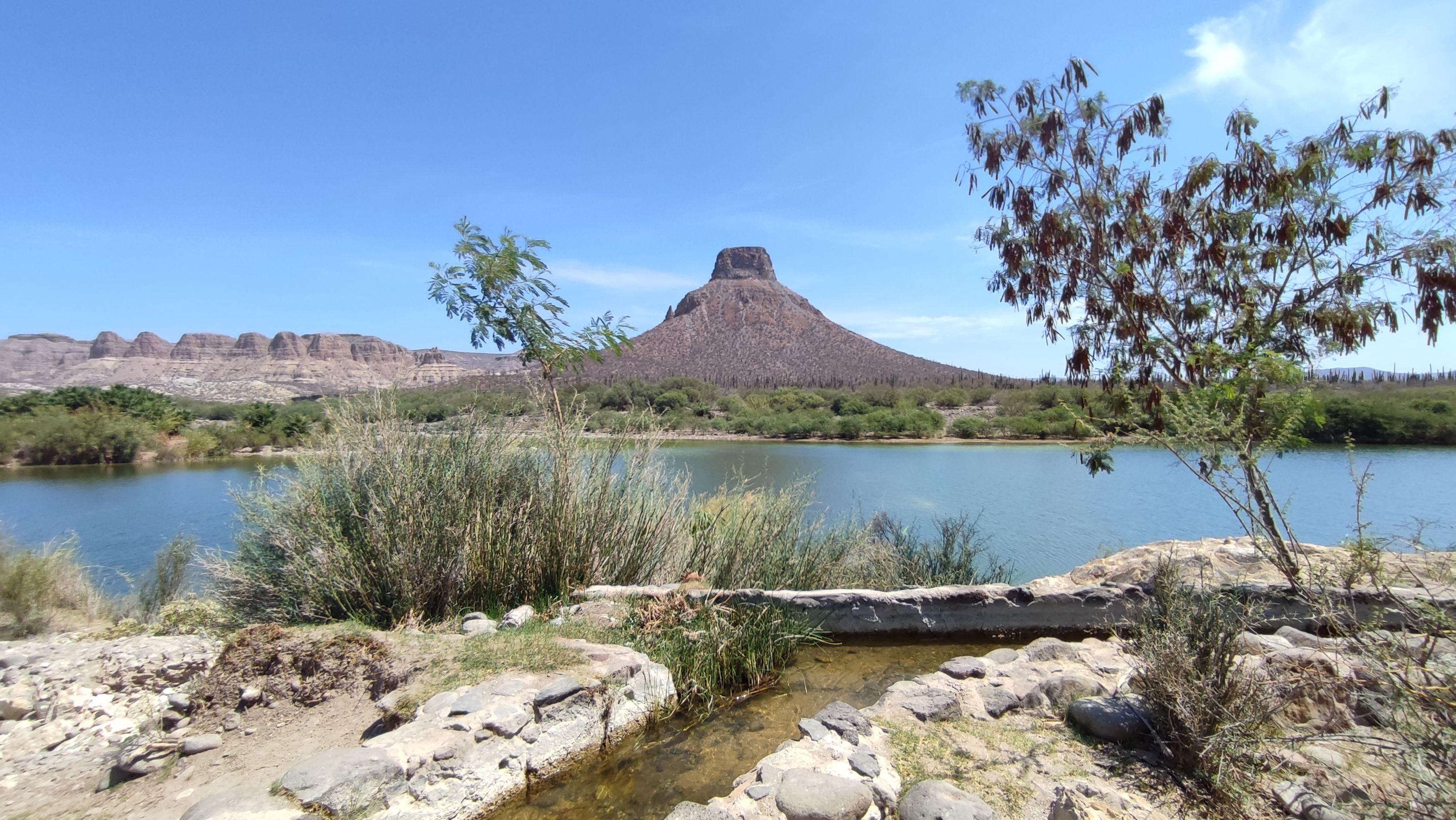
Water in the desert is a matter of life and death. And in the north of Baja California Sur, life is sustained through the water of the La Giganta and Guadalupe mountain ranges.
Baja California Sur, in northwestern Mexico, is one of the 8 Latin American provinces and the only state in Mexico whose water stress is classified as extreme risk according to the World Resources Institute (WRI). This is because it uses 80% or more of the total water it has in a year.
With a view to protecting the water resources of the northern zone, the civil organization Sociedad de Historia Natural Niparajá A.C presented in 2014 a project to decree both mountains within a Protected Natural Area (ANP), in the form of a Biosphere Reserve, a designation given to an area to protect its natural wealth.
The project was taken up by the authority and has among its main purposes to protect water, the most critical resource for the development of an arid region such as Baja California Sur, as expressed in the Prior Justification Study published by the National Commission for Protected Natural Areas (Conanp), which explains the justification and objectives of converting mountains into ANP.
Despite having the support of the authority, the rejection of the communities keeps the project paralyzed.
The area that is intended to be protected is 1.6 million hectares. It starts near El Mechudo, a rocky cliff and ends in the south of the town of San Ignacio, corresponding to the municipalities of La Paz and Mulegé, respectively. In the area there are around 34 basins associated with the La Giganta and Guadalupe mountain ranges, an important hydrological recharge area that feeds the Mulegé, Comondú and Loreto aquifers.
Organizations such as the Citizens Front for the Defense of Water and Life and the Council of South Californian Academics accuse of inconsistency that the same area that is intended to be protected by its water resources has at least 16 mining concessions, which although inactive, are still in force, as mentioned in the Preliminary Justification Study.
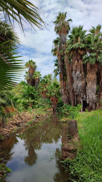
San José de Comondú, an oasis in the mountainous mountains. Credit: Daniela Reyes.
Communities reject the ANP project
Two hours from the capital of the municipality of Comondú, in the middle of large mountains, with a road in poor condition and without public or private transport, a scarce telephone signal and expensive and poor internet service, is San José de la Noria, a community of 90 families dedicated to livestock.
The number of inhabitants in the entire extension of the Sierras Giganta and Guadalupe is relatively low (approximately 4,420 according to the Population and Housing Census of the National Institute of Statistics and Geography of 2010) and there are about 485 small ranches and scattered communities that have their own assembly of ejidatarios, the highest authority in the ejido, organized through councils.
José Manuel Talantes Cota is president of the ejidal commission and although his father was the founder of the community and has his ranch and cattle in San José de la Noria, his life is more tied to the city, due to the lack of communication from the community and the lack of educational and work opportunities.
This community rejects the ANP project that would absorb 99.7% of its territory because they fear that the authorities and individuals will misuse it and that activities in the industrial estate will be restricted, affecting its economy and its uses and customs.
“For me it's alarming to have to give it (the land) to Conanp. Nor do I see the need to make the declaration for the government to fulfill its obligation, which is to take care of it together with me,” says José Talantes.
In San José de la Noria, three people make up the supervisory board and are responsible for taking care of the 89,885 hectares that cover the surface of the ejido, with the resources they have enough to make three monthly tours of the area.
These activities and the community in general are supported by resources from federal programs, such as the Management Unit for the Conservation of bighorn sheep, a species subject to special protection by the Ministry of Environment and Natural Resources (Semarnat).
Although this model provides funds to implement environmental care with the rational, orderly and planned use of resources, it is not enough, and some members of the communities see mining and tourism and real estate development as alternatives for greater economic income, without thinking that it will have a high ecological cost.
To address the economic situation of the inhabitants, Mareli Higuera Arce, president of the commissioner of Ejido La Purísima, says that they have received promises of resources that they will be able to access once the ANP is decreed and that this will promote ecotourism development in the region.
However, with the creation of new protected areas and with a 7.3% cut to the Conanp budget, there will be $9.70 pesos for each protected hectare in 2023. Currently, the biggest challenge is the operation and management of areas already declared in accordance with the report “Taking Care of What Matters” prepared by Noroeste Civil Society for Environmental Sustainability (Nossa), an alliance of civil organizations that analyzes the budget for environmental protection.
Communities like La Purísima, which have been dedicated to ecotourism for years, feel underestimated and believe neither in the justification nor in the environmental benefits of the ANP project.
In 2014, the communities united and signed the Cadejé Pact, where they reject the ANP declaration of their territories, since instead of benefiting them, they consider that it would be an obstacle to tourism development and their properties would lose value.
“We're going to own land that we're just going to be able to see from afar, that we're not going to be able to sell, we're not even going to be able to kill a puppy or cut wood because the ANP doesn't allow it... These communities have spent years and years, and generation after generation without the government seeing them and they've survived, so right now it's not going to be the exception,” says Higuera Arce.
According to the management proposal made for the ANP, the most significant restrictions would be those identified as core areas that feed aquifers, which represent 1.55% (25,260 hectares) of the total surface (1.6 million hectares).
There, polluting activities, modifying hydraulic flow, exploiting and exploiting flora and fauna, introducing wildlife specimens, other than those established in the ANP declaration and in the Management Program, a planning and regulatory instrument for the management and operation of the area, could not be carried out there.
The remaining 98.4% will be the buffer zone that would be divided into sub-zones and it will be until there is a proposal for a decree where it will be established in detail what type of preservation, traditional use, resource and ecosystem use, public use, human settlements and recovery activities can be carried out and in which polygons.
For now, what the Justification Study establishes is that in these subzones, only productive activities undertaken by communities up to the time of the declaration and that are compatible with the ANP project can be carried out.
The area would be under the administration of Semarnat through a management for the area and an advisory board for operation and management, while the inspection and surveillance for compliance with all provisions would be Profepa.
Both communities agree that they do not agree with someone else managing their resources and misusing them, when the solution is for authorities such as Semarnat and Profepa to do their job properly, collaborating with surveillance, responding to complaints and providing them with more resources through conservation programs.
The ideas and opinions of those who are ejidatarios play an important role, since 81.5% of the polygon (1.3 million hectares) is ejido property in which 20 ejidos are located, of which at least 13 still reject the project.
For the latter, the only ones who benefit from this project are the federal government and civil organizations, which, with the argument of an ANP, are going to attract more economic resources.
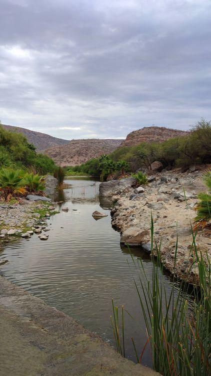
San Miguel. Credit: Daniela Reyes.
The mountains: a pillar of the hydrological system in BCS
Saúl Chávez López, researcher in the environmental planning and conservation program at the Center for Biological Research of the Northwest (Cibnor), explains that the hydrological system of Baja California Sur depends entirely on water extracted from the subsoil because it does not have rivers.
Aquifers are mainly recharged from rainwater associated with hurricanes. However, while in the south there is a rainfall of 400 millimeters per year, as you move north, the climate becomes increasingly arid and the scarcity of rain increases, with for example four times less rainfall than in the south.
According to the Preliminary Justification Study, the Sierras La Giganta and Guadalupe polygon provide an average annual runoff of 271 millimeters per 106 cubic meters; water necessary for communities to carry out their domestic and productive activities.
In the study, Niparajá argues that these mountains provide water to almost 50% of the localities in the state, where 20% of the population lives and supply water to the region where 76% of state production is sown and harvested.
These communities are mainly dedicated to livestock, agriculture and to a lesser extent fishing, hunting and tourism. However, these first two activities represent an environmental threat to the area due to deforestation and environmental fragmentation, the result of land allotment and privatization.
These activities, which threaten water resources by overexploiting them, are also vital for the majority of the population that depends on them for their livelihood.
However, Higuera Arce de La Purísima insists that at least in its ejido there is no overexploitation, “it's just manipulation” and that this is only present in the municipality of Comondú, specifically in Ciudad Insurgentes and Ciudad Constitución, where the wells that supply agricultural production are located.
Communities such as La Purísima and San José de la Noria remain firm in their refusal because they believe that to prohibit mining and protect water resources, flora and fauna, it is not necessary to decree an ANP.
Other ways to protect water
Dr. Janette Murillo, a researcher at the National Polytechnic Institute and member of the Council of South Californian Academics (CAS), points out that in order to address the water problem, it is urgent to create and update Local Ecological Management Programs (POEL), especially in the area where aquifers are recharged.
The POEL is the environmental policy instrument at the municipal level that regulates or induces land use and productive activities in a region through processes that seek consensus and balance between environmental preservation and economic and social development.
The programs of the municipalities that cover the mountains (La Paz, Comondú, Loreto and Mulegé) must include hydraulic works such as dams to hold and store the largest amount of rainwater and the reduction of water concessions for industrial use by companies that need much more resources than other inhabitants who carry out small-scale agricultural activities, according to Saúl Chávez López.
These results were documented in the short film “The Earth, the Water and the Dry”, which was part of the “Flourishing of the South California Ranch” project promoted by the community itself and which received financial support from the A.C. Solidarity Action Fund (FASOL).
Part of the South California Ranch Flourishing project.
This case is an example of land sharing by academics, who argue that alternative, diverse and agroecological agriculture can maintain biodiversity at the landscape level, integrating production and conservation.
They demand shielding the area from mining and tourism development
Juan Ángel Trasviña Aguilar, advisor to the Citizens' Front for the Defense of Water and Life and president of Environment and Society A.C., points out that it is totally inconsistent that there are mining concessions in the area being protected.
Although the ANP crosses four municipalities, 71.5% of the surface is located in the municipalities of Mulegé and Comondú, which together total 1 million 162 thousand 415 hectares of the 1.6 million that make up the total area.
In these two municipalities there are 1,567 water concessions in force with the capacity to extract 209 million 483 thousand 681 cubic meters of water per year, equivalent to 190 million 500 thousand thousand one hundred liter tanks, of which 61% are used for agricultural activity.
These municipalities are stalked by mining projects. Mulegé and Comondú have 62 registered mining concessions that compromise 305,000 hectares of their territory.
Given this, Trasviña requires that the ANP declaration and management program make it clear that no extractive projects such as mining and fracking that destroy the relief and shape of the landscape, impact flora and fauna and permanently contaminate bodies of water will not be allowed.
This is because the Sierra La Laguna Biosphere Reserve, a recharge area for the aquifers that supply the municipalities of La Paz and Los Cabos in the south of the state, has been threatened since 2008 by mining projects.
As well as to protect yourself from tourism and population development projects, which also break ecological balance and jeopardize water resources, uses and customs and the rights of the inhabitants.
“Protected for whose benefit?” , questions Trasviña Aguilar, since for him the only beneficiaries of the ANP project without these clarifications would be a small group of mining companies and politicians and businessmen who promote tourism development, but not populations and the ecosystem.
The future and modifications to the ANP project
The issue of the ANP was paralyzed until July 2022 when the governor of the state of Baja California Sur, Víctor Castro Cosio, met with the head of Semarnat, María Luisa Albores González, and announced that he would resume the project to shield the saws against mining.
By September, rumors were strong that the governor was going to publish the decree to declare the new ANP and the ejidatarios intensified their demonstrations of rejection.
In response, federal deputy Alfredo Porras, on behalf of the governor of Baja California Sur and the president of Mexico, Andrés Manuel López Obrador, made a live broadcast with Adán Peña, head of Conanp, where he assured that there would be no ANP decree without the acceptance of the ejidatarios.
He also pointed out that the authorization of any “toxic open pit mine” in the polygon or increases in agricultural exploitation will not be allowed, unless there is a greater recharge from the aquifers than is usually recorded.
For his part, Adán Peña announced that a consultation process would be undertaken to dialogue with communities and explain the project to them with new modifications, including a reduction of the polygon to be protected and the programs they could access in the future.
“Rest assured that we are going to talk to you. We invite them to welcome us to their ejidos,” he says in the video.
However, the communities say that they have not had contact with the authorities nor have they received any documents with the updates to the project.
Since 2014, when the ANP project was presented, it was also proposed to hold a citizen consultation that has not been carried out to date. A point with which the counselor at the front agrees.
“It is very important to consult all the people who are directly and indirectly related to the mountains, because all populations, in cities, ranches, ejidos, receive direct and indirect benefits from the mountains,” says Trasviña Aguilar, who points out that it is important that campaigns be carried out with unbiased information about the project and then carry out the consultation

Comentarios (0)